
KTNB 27 TRI-CITY NEWS | WEATHER DESK
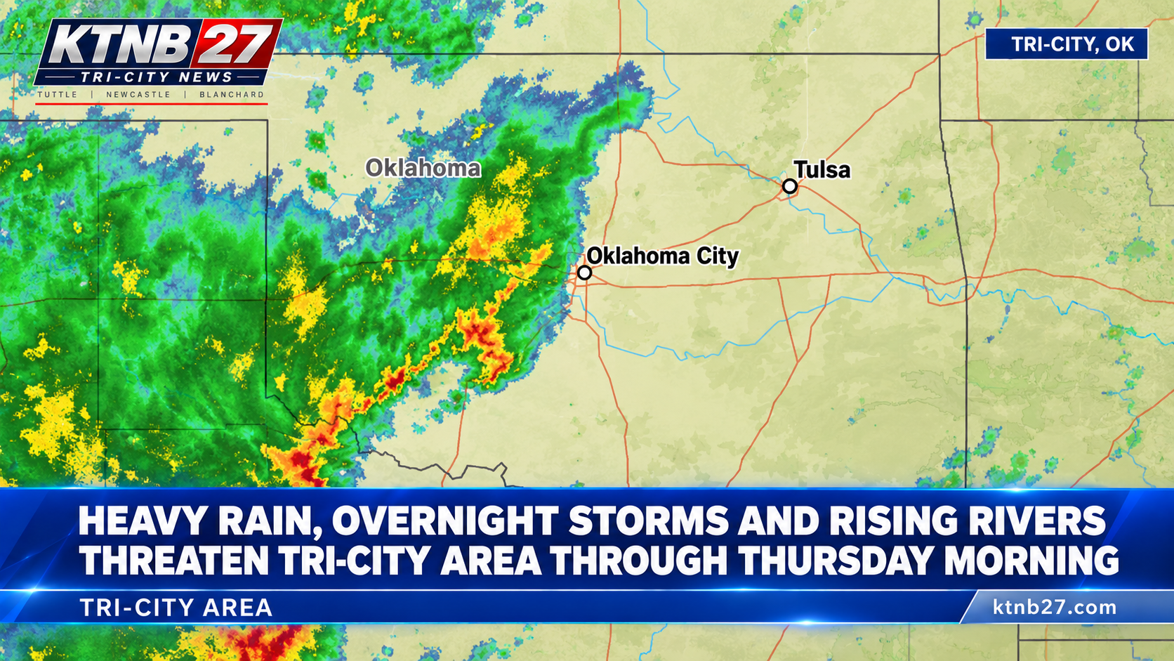
Heavy Rain, Overnight Storms and Rising Rivers Threaten Tri-City Area Through Thursday Morning
TUTTLE • NEWCASTLE • BLANCHARD | Wednesday, October 14, 2026 — Evening Weather Update
Residents across the Tri-City area are facing another unsettled night as multiple rounds of thunderstorms threaten to bring additional heavy rainfall, dangerous road conditions and an increasing risk of flooding through Thursday morning.
The National Weather Service in Norman is warning that severe thunderstorms remain possible across central Oklahoma tonight, with damaging wind gusts and flooding rainfall serving as the primary concerns. Large hail and an isolated tornado cannot be ruled out.
And unlike Oklahoma’s usual practice of delivering an alarming weather forecast before quietly moving on with its evening, this system has already produced significant rainfall and flooding across the region.
Some portions of western and central Oklahoma have recorded 4 to 11 inches of rainfall since the storms began. Much of that water is still working its way through drainage systems, creeks and rivers.
What to Expect and When
Wednesday, 8 p.m. – Midnight
Thunderstorm chances increase during the late evening, particularly around 9–11 p.m. Periods of heavy rain and strong wind gusts are possible. Temperatures remain in the lower to middle 70s.
Thursday, Midnight – 5 a.m.
A temporary reduction in thunderstorm activity is possible, but flooding remains a concern even between storms. Additional development is expected toward daybreak.
Thursday, 5–10 a.m.
Another period of thunderstorms and heavy rainfall is forecast, potentially affecting school drop-offs and the morning commute. Rain chances around Newcastle reach approximately 70–75% during several morning hours.
Thursday, Late Morning – Afternoon
Storms become more scattered as a cold front approaches. Additional thunderstorms remain possible during the afternoon before conditions begin improving behind the front.
These are forecast windows, not guaranteed storm arrival times. Individual communities may experience rain earlier or later depending on how thunderstorms develop overnight.
Flooding Is the Most Immediate Concern
The National Weather Service issued a Flood Warning affecting portions of the Oklahoma City metropolitan area, including Newcastle and Tuttle, through 9:30 p.m. Wednesday.
The warning reported widespread rainfall totals of 3–6 inches in affected portions of the metro area, with standing water, swollen streams and drainage issues continuing even after rainfall stops.
More concerning for the Tri-City area is the developing situation along the Canadian River.
A separate Flood Warning forecasts minor flooding on the Canadian River near Mustang from early Thursday into Friday. The river is expected to crest near 23.5 feet Thursday evening, above its 22-foot flood stage.
Low-lying roads, agricultural land and areas near the Canadian River between Tuttle and Newcastle could experience flooding.
Another Flood Warning anticipates moderate flooding along the Canadian River at Norman, potentially affecting low-lying areas near the Cleveland–McClain County line.
Residents traveling near river crossings, rural roads and low-water crossings should pay particular attention to changing conditions.
The standing rule remains simple: If water is covering the road, turn around. A road that was accessible during the afternoon may not remain that way overnight.
Thursday Brings a Change
The storm system should begin shifting east and northeast on Thursday as a cold front pushes across Oklahoma.
Daytime temperatures around the Tri-City area are expected to reach the middle 70s before cooler air arrives later in the day.
By Friday morning, temperatures could fall into the upper 40s or lower 50s, with a much cooler afternoon expected.
After several days of excessive rainfall, Thursday’s front should eventually bring the region an increasingly welcome combination of cooler temperatures, improving skies and substantially less precipitation heading toward the weekend.
KTNB 27 Weather Desk Outlook
For Tuttle, Newcastle and Blanchard, the overnight priority is straightforward: monitor warnings, stay aware of rising water and allow additional travel time Thursday morning.
The exact placement of the heaviest thunderstorms remains uncertain, but the atmosphere has enough moisture to produce dangerous rainfall rates in a relatively short period.
Oklahoma has apparently decided that October should include all four seasons, a severe weather briefing and a practical examination in flood management.
Residents are advised to keep weather notifications enabled overnight and check road conditions before Thursday’s commute.
KTNB 27 Tri-City News — Local News. Allegedly.™
Forecast basis: NWS Norman Area Forecast Discussion issued October 14 at 1:32 p.m. CDT, supplemented by evening local forecasts and NWS flood alerts. Forecast conditions and warning areas are subject to change.
NWS Live Radar — Central Oklahoma
Open NWS Interactive Radar
Official NOAA radar with precipitation animation and active warning overlays. Select central Oklahoma or the KTLX radar.